The Surface Water and Ocean Topography mission is a satellite altimeter jointly developed and operated by NASA and CNES, the French space agency, in partnership with the Canadian Space Agency and UK Space Agency. From Wikipedia
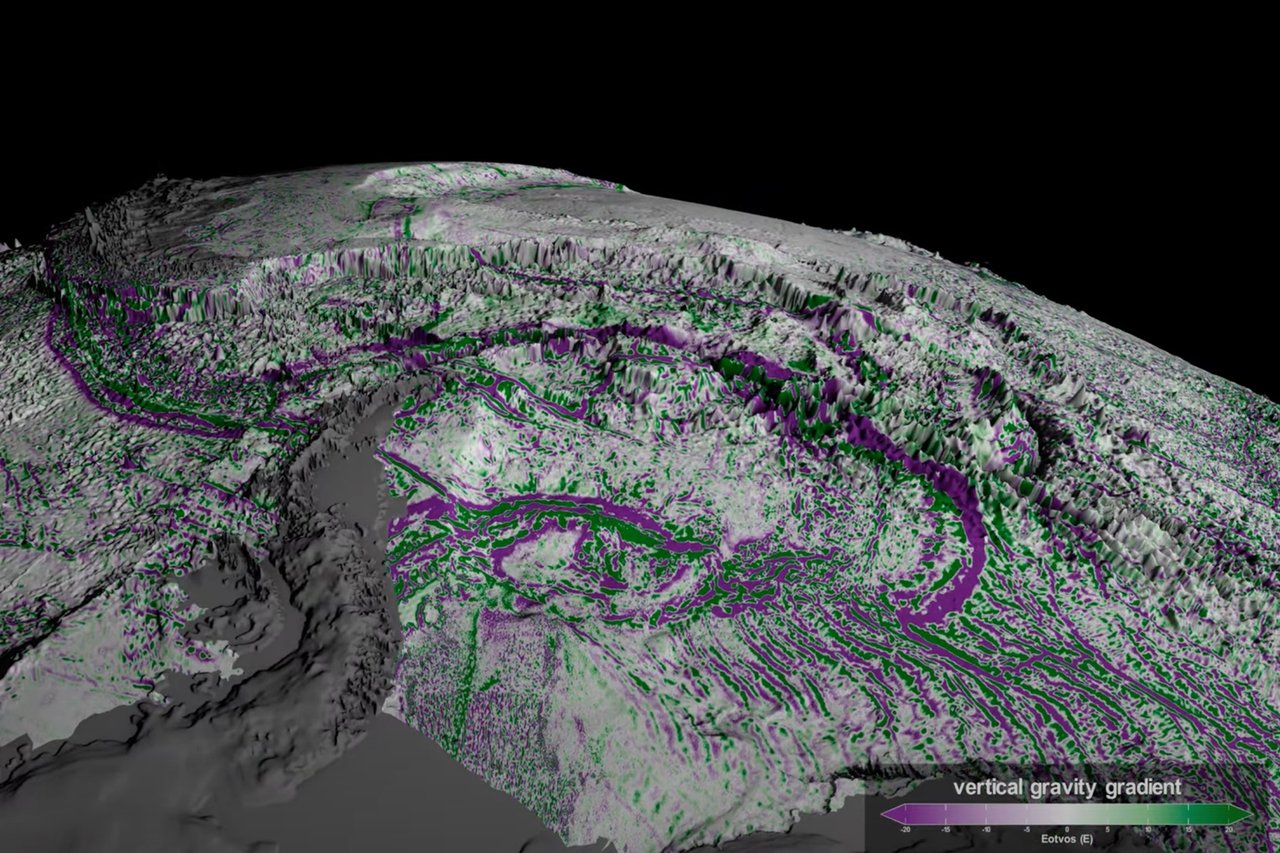
The satellite, initially designed to measure water height, has doubled the resolution of previous maps and revealed 100,000 underwater features, advancing global seafloor mapping efforts.