Overview
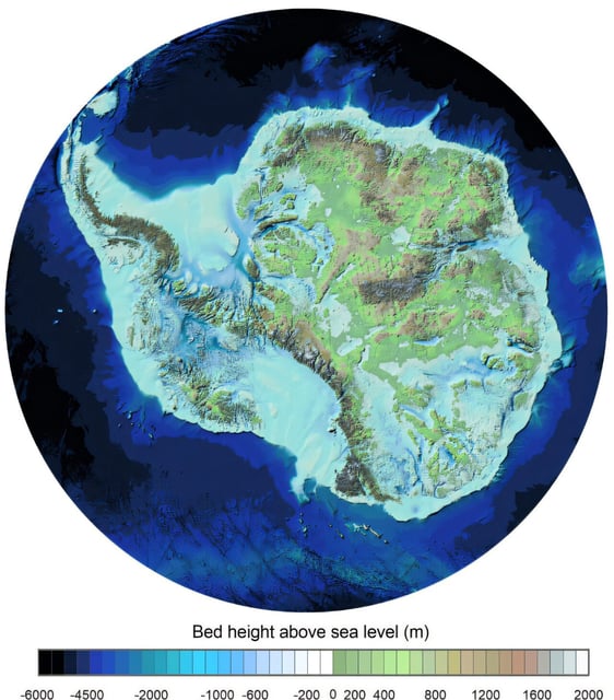
- The British Antarctic Survey (BAS) has released Bedmap3, the most detailed map yet of Antarctica's sub-ice topography, based on six decades of data collection.
- The map reveals the continent's tallest mountains, deepest canyons, and areas of thickest ice, with some ice layers exceeding 4,757 meters in depth.
- Bedmap3 highlights critical grounding lines where ice meets the ocean, a key factor in understanding ice sheet stability and potential sea level rise.
- The findings show Antarctica's ice sheet is thicker than previously thought but also more vulnerable to melting due to warm ocean water intrusion.
- If all Antarctic ice melted, global sea levels could rise by approximately 58 meters, underscoring the map's importance for climate modeling and mitigation efforts.