
Overview
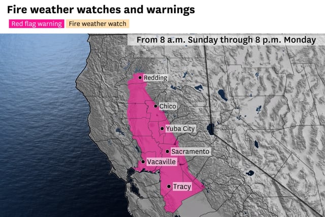
- A red flag warning is in effect from 8 a.m. Sunday to 8 p.m. Monday across the Sacramento Valley, northern San Joaquin Valley, and eastern interior East Bay.
- Forecasts predict wind gusts up to 35 mph in lower elevations and up to 55 mph in higher terrain, with relative humidity dropping to single digits in some areas.
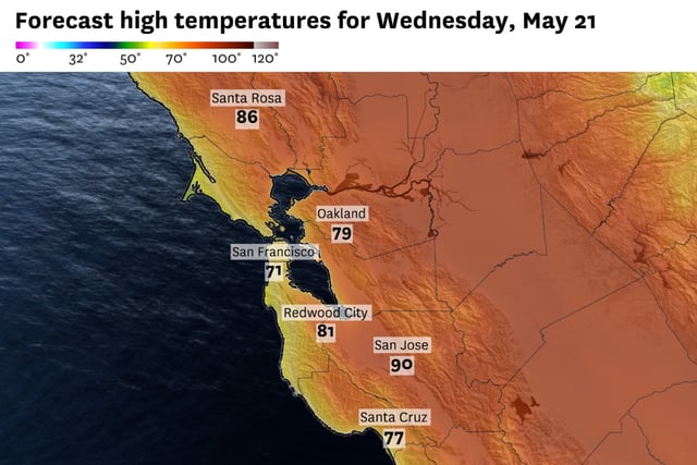
- Temperatures are expected to climb into the high-80s and low-90s in inland areas by midweek, further drying out vegetation.
- Residents are urged to avoid activities that could spark fires, such as driving over dry grass or leaving open flames unattended.
- Pacific Gas & Electric has stated it does not anticipate preemptive power shutoffs during this warning period but continues to monitor conditions.