Overview
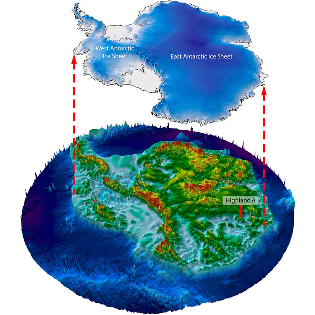
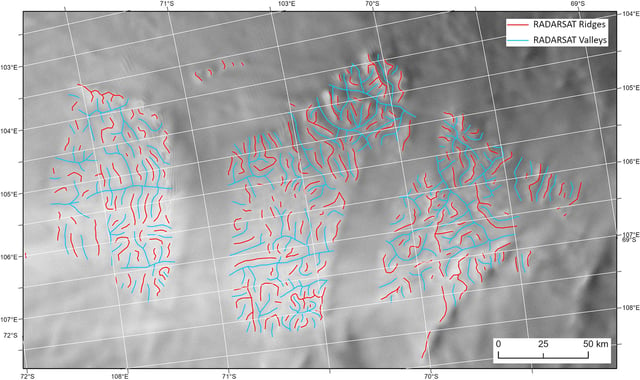
- Scientists used satellite data and ice-penetrating radar to discover a vast, ancient landscape under the East Antarctic ice sheet that was formed by rivers prior to the continental build-up of the East Antarctic ice sheet.
- The found area beneath the ice sheet is larger than Belgium and estimated to have been undisturbed for between 14 and 34 million years.
- This ancient hidden landscape consists of ancient valleys and ridges, similar to the present-day landscape of Wales in the UK, hinting at the long-term temperature stability of the ice sheet in the region.
- The discovery enhances scientists' understanding of the history and evolution of the East Antarctic Ice Sheet and contributes to climate change predictions, specifically pertaining to the potential sea level rise induced by the melting of the ice sheet.
- Despite the immense thickness of ice coverage, careful observation of satellite images and use of radio-echo sounding data have gradually made this discovery possible.