Overview
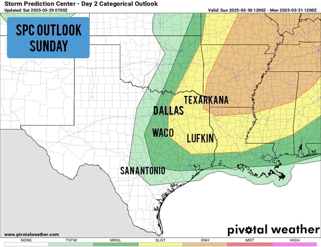
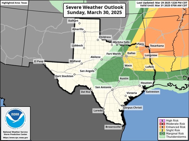
- Northeast Texas, including Texarkana, Longview, and Mount Pleasant, faces a Level 3 out of 5 risk for severe storms this afternoon and evening.
- Storms in the affected areas may produce large hail, damaging winds, and isolated tornadoes, with the highest activity expected between 5 p.m. and 10 p.m.
- Houston and San Antonio are expected to remain mostly dry, with only isolated showers or weak thunderstorms possible and storm chances below 20%.
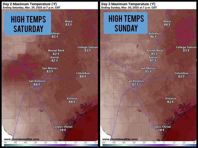
- Temperatures across Texas are 10 degrees above seasonal averages, with highs in the mid-80s to upper 80s expected today.
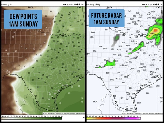
- A weak cold front will move through South Texas on Monday, slightly lowering temperatures, while a more significant weather system is being monitored for next weekend.